Coloma

Back on June 26, 2016, I wrote about the South Fork American River Trail – strip of dirt that stretches 25 miles from Folsom Lake to Coloma. Back then I posted a few pictures and talked about the first four miles of that trail. On the Folsom Lake end. I expressed a desire to hike the entire length of the trail one day.

And then this happened. And that. And I haven’t been back.

One reason is that it is an effort I would rather not attempt on my own and the lack of a hiking partner has put the effort on the back burner. Another reason is an injury that seems to keep my mileage — whether a run or a walk — limited to 6-8 miles at a go. Which makes a 25 mile hike a daunting task.

I also have been derelict in getting to the river and fulfilling the objective I set out for this blog. I haven’t posted here in eight months. I have been back to the river. Lately I’ve tried to join a friend for a weekly run along the river. But that’s not the time for picture taking.

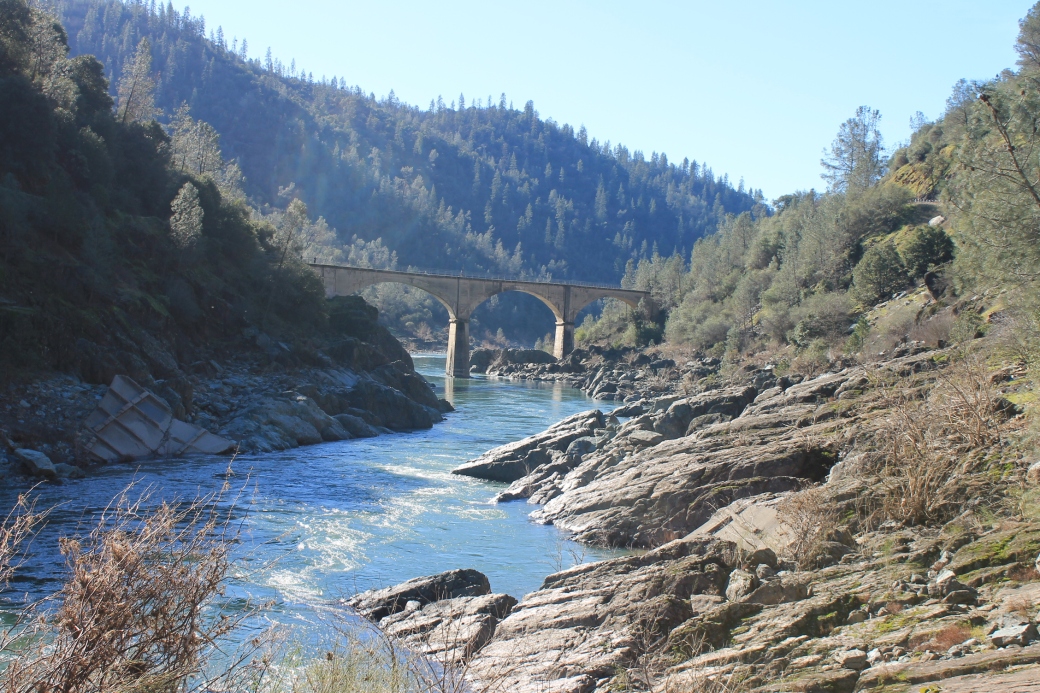
I needed to do something this weekend by myself. I needed to get out of the house and re-connect. I needed some space. Some quiet. I also wanted to go to a new place. Not back to the confluence near Auburn. Or the portions of the river go through Sacramento.

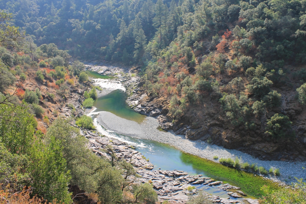
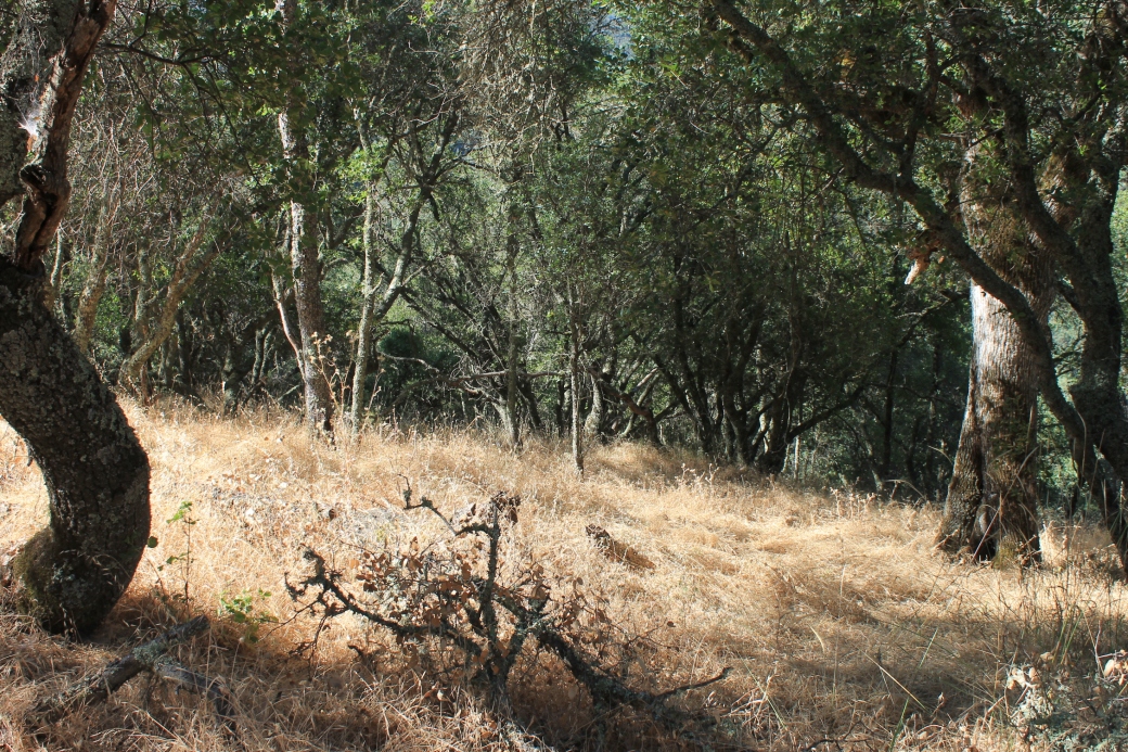
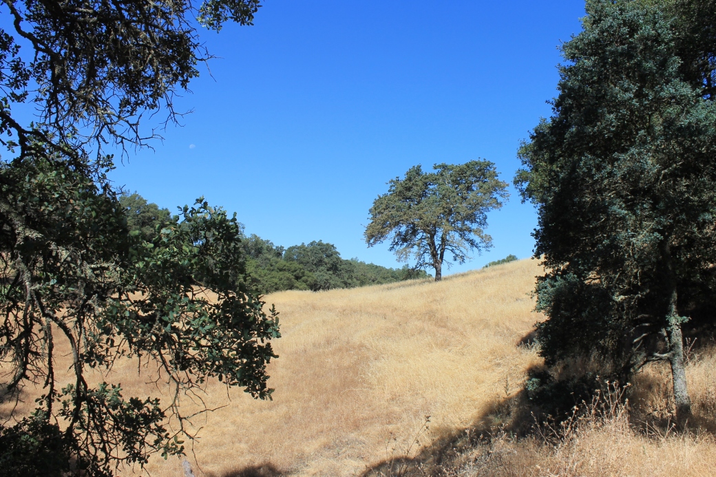
And I considered that 25-mile hike. So, I went to Coloma to explore the trail from the other end.

IMG_8295

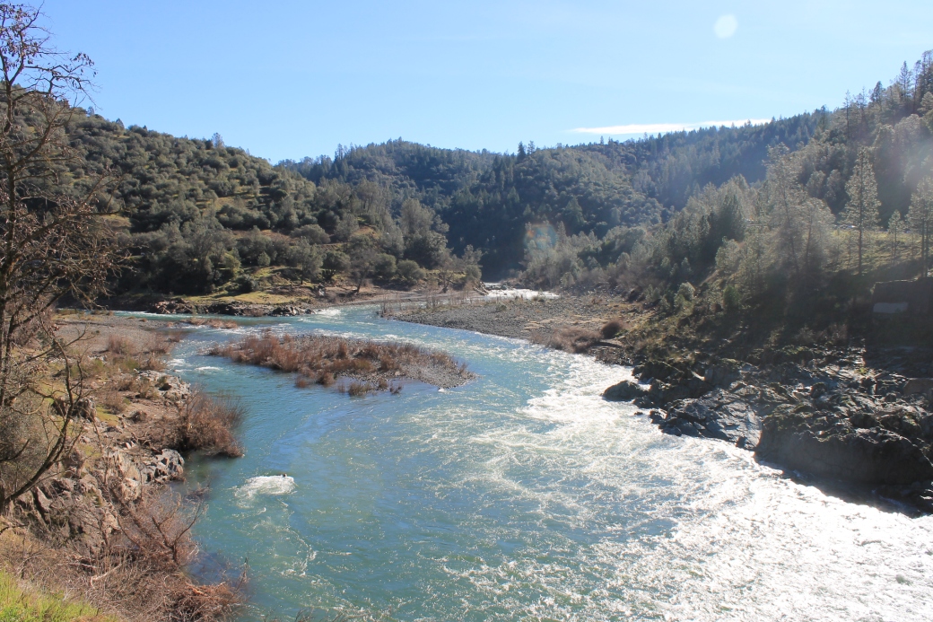
As a resident of Sacramento for more than 50 years, I’ve been steeped in the history of the area. This is the place where gold was discovered by John Marshall in 1848. Just on the other side of the river from where I was standing when I took this picture.

There is a State Park here with plenty of old buildings and monuments. It’s a nice little step back into history.

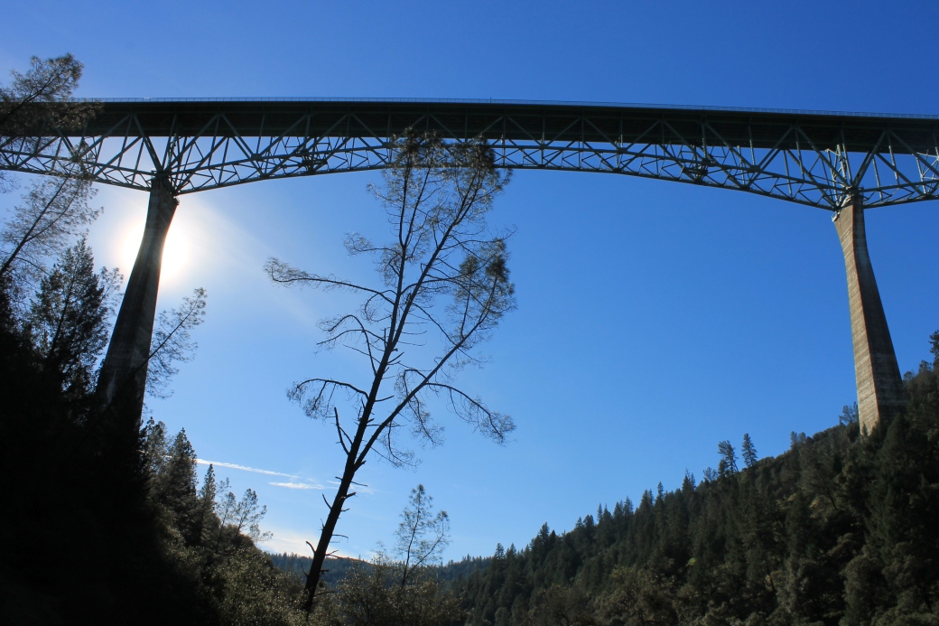
What isn’t there, however, is the end point for the South Fork American River Trail. On the north shore of the river, there is a trail. It peters out after less than a mile. I walked it, hit a dead end, tried a little further. I went back and asked a park employee.

No, the trail isn’t complete. There are bits and parts of it, but the entire 25 mile trail has not been completed.

So …

Now what?

I bought a book in the gift shop at the State Park that has a lot of info about trails along the American River. I guess that will be next.

Things could be worse.

IMG_8304


The Confluence, Revisited

Just outside of Auburn, the North and Middle Forks of the American River join. Almost two years ago, I paid my first visit to the spot. It was spring then, at the end of another dry rainy season. Since I wandered the area, I’ve wondered what it might look like in a wet year. Well, we’ve had a wet rainy season this year so far.

I wanted to get back up to the confluence the last couple of weeks, but didn’t make it until today. I had heard reports that in the midst of the storms, the river was raging. The waters behind Lake Clementine were so high that the water was spilling over the top. I dilly dallied and delayed.

Here are a couple of pictures I took from similar vantage points almost two years ago. Compare them to the pictures on the linked post.

img_7813

img_7807

They show a river that is wider and deeper, but not raging anymore.  The next time we get a major storm through here, I’ll have to head back a whole lot sooner.

I thought of heading to Lake Clementine for some shots of the dam, just in case the water was still overflowing. The round-trip hike was about 5 miles. I had come unprepared. No water or snacks. I decided to put that off for another time as well since I figured the water couldn’t still be doing so. I asked a couple of young ladies who had come from Clementine. “Oh yeah, still is,” they said. “It’s worth it.” Sigh.

I still find it amazing that this place would have been submerged if the Auburn Dam plans had been successful.

One last picture…

img_7790


Scenes From A Swollen River

There’s a spot along the American River I have been to several times in the couple of years I’ve had this blog.  It’s easy to access and I go there to see what happens to the river in different seasons.  It’s right under the Howe Avenue Bridge.  It’s where I took this photo.

IMG_6981

I’ve used that old concrete pipe as a marker.  So far, nothing seems to change the level of the river in relation to that pipe.  Until the storms of the past week or two.  I went back to the spot.  To get there I park near a dog park on University Avenue and walk over the levee.  The bike trail runs by under the bridge and on the other side of it there’s a drop off of about 10 or 15 feet and then there’s the river.  Usually.

img_7741

The Stop sign is where the bike trail is.  The mud in the foreground gives you an idea of how high the river was at its highest in recent days.  What this tells me is that the river at this spot is likely at least 20 feet higher than it has been over the past couple of years.

I went to a few other places I’ve been.  Sailor Bar.  Not accessible.  Closed due to “public safety.”  The pedestrian bridge to the west of Sunrise Boulevard.  Also closed.

img_7751

Last I was here, I could walk under the bridge.  In the winter.

Here are a few more pictures.  First thing I did was head over to the Watt Avenue Bridge to capture the sunrise.  Watt Avenue is a bridge I’ve driven over for more than 50 years.  In the memory of my childhood, in the winters the river was always high and in the summers it always seemed perilously low.  That changed somewhere along the way as they changed the rules for managing the flow of the river.  For years it seems to always be somewhere in the middle of those two extremes.  Again, not today.  The river as it passes under the Watt Avenue Bridge covers a small parking lot, a portion of the bike trail and reaches part way up the access road that goes over the levee.  It is wide and deep here.

img_7734

img_7728

This is from a spot east of Sunrise Boulevard.

img_7745

Rumor is there is another atmospheric river headed our way.  I may go back next weekend. I just wish I could get access to some of those other spots.


Stevens Trail on the North Fork

In my last post, I announced I hoped to hike a 25-mile trail from Salmon Falls Bridge to Coloma.  Those plans were crushed on the rocks of a few issues.  First, to do that hike on that trail I need a hiking companion or two.  I haven’t found that companion yet.  And the truth is I haven’t looked that hard.  I have issues with my right thigh and hip that seem to announce their presence in a loud voice right around six or seven miles of hiking.  Unless I can get past that, the idea of going for 25 miles is somewhat ridiculous.

Today, I walked the Stevens Trail on the North Fork of the American River.  I went with a co-worker and his wife.  The trailhead is in Colfax.  It meanders along the river for about four miles before it drops you off at the river.  The question though is whether it is really four miles.  One article I read says the out and back is 8.3 miles.  Another says it is 7.7 miles.  And the sign at the trailhead says it is 4.5 miles to the river.

All I know is that the views along the trail are beautiful.  There is something incredibly peaceful and restoring about this…

IMG_7548

The hike down to the river seemed relatively easy.  There was some up and down, but it was relatively easy.  Once we got to the water’s edge, we waded about for a bit.  It was nice to get into the cool water and just be quiet for a few minutes.

IMG_7564

We began the hike back.  And we went uphill fooooorrrrrrreeeeevvvvveeeeeeerrrrrr.  It is odd how what seemed to be some up and down, without anything that seemed like it would incredibly demanding on the way back became a long, long slog back to the trailhead.  And, yes, my right hip and thigh weakened towards the end and made it difficult for the last mile or so.  Getting old sucks.

South Fork

I’ve been absent from here for far too long.  There are reasons for this, primarily those that revolve around the fact that I have a life.  A job and family and many other interests.  Getting to the river doesn’t always fit into everything else going on.

There’s another reason.  For the last three years I drove a Nissan Leaf — an all-electric car with about 70-80 miles of range.  Which means there’s a pretty limited area of the world I can explore.  I could have kept going back to places within that range, but I want to see places along the river I’ve never been too.  The reality is that most of what I could cover by getting there in my Leaf exists entirely within the American River Bike Trail system — an incredible place to bike and hike and enjoy the river, but I’ve been in that system hundreds of times over the last 40 years.

Part of my effort with this blog and my exploration of the American River is that I really would be exploring places I’d never been before.  So, I was a bit limited and my interest waned.

A couple of months ago the lease on my Leaf ended and I replaced it with a Chevrolet Volt.  Still an electric car, but with a gas engine backup.  In the two months I’ve had it, driven almost exclusively on the battery, but having that gas engine means I can now stretch the boundaries of my exploration.  I’ve spent the last few weekends planning my first venture.  I’ve thought of heading back up to the confluence, where the North Fork and the Middle Fork join, but I’ve been there.  (I’ll be back again because there are so many more trails and pieces of the river to explore there, just not yet.)  I wanted to go somewhere new.

The South Fork.  I discovered there is a South Fork American River Trail, that stretches 25 miles from the Salmon Falls Bridge, where the South Fork empties into Folsom Lake, and Coloma, where gold was discovered in 1848.

IMG_7217

I decided I wanted to walk the length of this trail.  All 25 miles.  Just not yet.  I need to work up to that.  I may be able to run four miles or six miles or eight miles.  And, yes, I’ve run a few half marathons.  But I’ve learned that walking uses different muscles and just like with running, I’ll have to work up to something like a 25 mile jaunt.

I started today, arriving at the Salmon Falls Bridge trailhead a little before eight and heading out.

IMG_7188

I turned my back on the bridge and the river and began.  And except for one glimpse, never saw the river again.  Distances are estimates based primarily on the time it took me to hike the stretches.  But I believe I hiked about four miles out.  The first 1 1/2 miles or so were mostly uphill.  Until I got to this lonely little tree.

IMG_7210

As near as I could tell, this was the high point of today’s hike.  From here, there was a mile or so of mixed ups and downs, and than another mile or more of downhills.  At times I could hear the river.  It was right there.  But this is what I’d see.

IMG_7202

Nope.  No river there.  And the trail would then take me in the opposite direction.  Yes, for somebody interested in a river walk, this was a lonely experience.  I haven’t given up hope though.  I believe I got out about 4 miles before turning around.  In a week or two, I’ll try to get another 2 or 3 miles out before turning around.  I just hope that my hips and feet can take it.  My feet — primarily because of how my hiking boots rub against my heels and how my toes start to hurt!.  My hips — not so much while walking, but afterwards.

Here are a few more pictures.  I just hope there’s a point at which the trail gets me closer to the river.

IMG_7207

IMG_7209

IMG_7214


No More Drought?

Early on in my trips to the American River, I walked around Sac State and Howe Avenue and took some pictures.  In February 2015, we were in the midst of a multi-year drought and a ridiculous dry year.  I took this picture from under the Howe Avenue Bridge.

IMG_4235

The rainy season of 2015-16 has turned out quite differently than the previous few years.  It has rained enough to be considered a normal year.  The rain in the foothills and mountains has filled the reservoirs.  And now, for the first time in a couple of years, the Folsom Dam’s floodgates have been opened for the first time in four years.  Slightly.

Even though Folsom Lake isn’t close to capacity, there’s a reason for this.  Thirty years ago, there were storms that brought the level of the lake almost to the top of the dam.  A lake topping a dam is not a good thing.  So, the powers that be adopted new rules for water releases to ensure that there would be capacity in the lake for a major storm that could come again towards the end of the rainy season.

Although the water releases haven’t been that significant, you’d think they were emptying the lake from some of the uproar about the floodgates being opened.  Here’s the thing though.  Look at that picture up top.  Now, look at this one.


IMG_6981

Yes, the river is higher and that increase means more water flowing down towards the delta and to the ocean, but seriously, it isn’t much.

I remember when I was a kid, growing up in the 70s and crossing the Howe Avenue and Watt Avenue bridges.  In winter and spring, the river level was always high and in summer and early fall, it was always low.  Remarkably low some years.  It always amazed me how the river level varied throughout the year.

In the last couple of years, however, as I’ve paid more attention to these things, what amazes me is how consistent the river level is.  Whether winter, fall, summer or spring, it always seems to be very close to the same level.  I don’t know if that’s a good thing.  But, it does seem remarkable to me how the river level has been managed.  (Farmers down in the San Joaquin Valley may not be quite as impressed.)  And on a side note … it seems to be the same thing for the Sacramento River as it flows through Sacramento, where it is joined by the American River, and then on towards the Delta.  A consistent level throughout the year.

And with that, I find myself drawn to sunrises and sunsets these days.  I’ll leave you with this, taken yesterday morning somewhere east of Watt Avenue.

IMG_6979


I Needed Some Quiet Time

It’s been far too long since I had a little bit of alone time.  Since early September when I camped at Point Reyes for a couple of days.  So, I was desperate to get out.  A friend and co-worker is moving to a new neighborhood near the river.  He goes for his own river walks regularly because of how close he currently lives and will live to the river.  I’m envious of his opportunity.  I decided to beat him to it and rose early this morning with the idea I’d find his new neighborhood and walk along the river there.

I call this Sunrise Near Wilhaggin…

IMG_6218My objective was to get to the river in time for the sunrise.  The end of daylight savings time made that slightly difficult, but I got there early enough to get some good pictures of the colors created by the sun’s rise and the reflections off a very still river.

I walked about 1.5 or 2 miles down the river, along the dirt trails that parallel the bike trail IMG_6238and take you through the trees and bushes along the river.  There is a main  trail, with countless side trails branching off in all directions, each of those trails taking you to the river, where you get views like this…

At each spot is a slightly different view of the river and I could take countless photos of those views.  Equally important is the wildlife.  My best picture of a deer ever.

IMG_6250

My new little buddy I found along the way…

IMG_6244

And these will always be my favorite (Why? Because one of my novels begins with just such a bird feeding in the shallows of Sullivan Bay.  It’s called The Irrepairable Past and I’ve struggled with it over the last couple of years, but whenever I see one of these — and they are everywhere in Sacramento’s waterways — I get a little inspired to get back to it.  So here’s to you, Bob.)

IMG_6283

And there are trees…

IMG_6269

And those views…

IMG_6272

And, finally, the real reason for my walks…

IMG_6267

In my own little personal world gone mad, I am trying to re-connect to peaceful moments and natural parts of the world far removed from the crazy.  It’s why I started backpacking this year.  It’s why I walk along the river.  If for only a few hours, I can be quiet and enjoy some very simple things.

Earlier this year, I discovered the Sacramento Yoga Center.  I went to yoga once a week for a couple of months and one of the instructors began the class with the phrase above as what we should focus on during the session.  It’s Like This Now.  And, it is, and this is what I am working towards.  There are many ways to do it and walks along the American River are just one way I am working towards recognizing the value of that concept.